a set of sensors: HOW to Create and modify
A set of sensors is created in the Objects folder by selecting the object type “Set of sensors”.
In the sensor properties window, it is possible to:
- create new sensors, change their position and delete them;
- move, rotate and scale the set of sensors;
- associate sensors with facets;
- import and export sensors;
- change the color or scale of the sensor displaying.

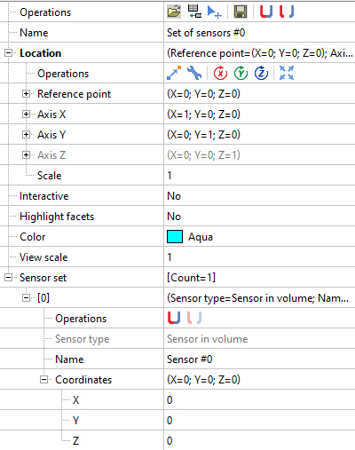
When you create a set of sensors, one sensor is already created by default. In addition to this sensor, you may create new sensors, move or delete them. There are no restrictions on the sensor creation - you may create as many sensors, as you wish.
Creating a set of sensors is always accompanied with creating a local coordinate system (LCS).
By default the LCS is aligned with the global coordinate system (GCS). The reference point of the sensor set is located at the LCS origin. You may offset the LCS and the entire set of sensors by changing the position of the reference point.

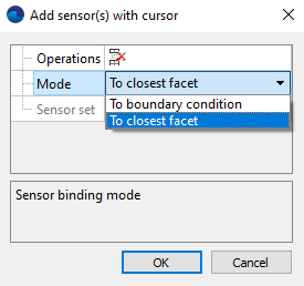
Also it is possible to attach sensors to any surface: for example, to a boundary condition or a moving body object. To associate a sensor to surface, just click on any surface. Then the sensor will be automatically attached to the surface with selected mode. There are two facet binding modes:
- attach to the nearest facet. (Even if this facet is hidden).
- attach to the selected boundary condition.

In this case it is very convenient to use the option “Facet highlighting”. It allows to highlight the facet to which the sensor is attached.

When sensor is associated to the facet, the integral data is taken by the sensor from the all facet surface. If the facet is very long, the data is interpolated to the point where the sensor is located.
Note: if the sensor is attached to the facet, which is moving, the sensor will move accordingly.

An important feature of the work with sensors is the possibility to import and export the location of the sensors. This functionality is especially useful when the sensors are arranged with a certain displacement step by a certain law.
To do it:
- Define a table with the sensors coordinates in any table editor software, for example MS Excel.
- Save this table as a text file.
- Import it to FlowVision.